Tuesday, August 17, 2021

Independence Pass and Woody Creek Tavern

 Carly Kovacik and myself did an ~5 mile roundtrip hike to an un-named 13,040 foot peak located on the Continental Divide. The trail departs from the Independence Pass parking lot and ascends gentle hills and alpine tundra. We made it past one sub-peak, then descended to a saddle, and then hiked up to our final destination. The whole area had that "Sound of Music" feel...green slopes, inspiring expansive views of hundreds of mountains, and mild breezy weather. We then hiked briskly back to the trailhead, with total elapsed time from car-to-summit-to-car being around 2 hours.

After the hike, Carly and I went to Woody Creek Tavern for a steak and fries dinner. The tavern is full of Gonzo-related posters, given it was a place that the Good Doctor himself frequented on occasion. In addition, pictures of various patrons were posted on all the walls, and the place had a generally very local vibe. Service was friendly and the food and beer was great...and being a fan of Hunter S. Thompson made the place all the more special for me.

Google map location is here.

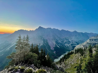
Pyramid Peak /Almost/

 Carly Kovacik and myself made an attempt on Pyramid Peak during early August. We initially missed the climbers trail that branches off from the tourist trail by about a quarter mile, and had to backtrack during the pre-dawn-hours. We eventually got back on track and soon began a grueling ascent up a long series of switch backs. That was followed by a traverse across a large boulder field that gave access to a 1000 foot climb up a very steep section of loose dirt and rock. We then reached a ridge and traversed across exposed ledges. We finally reached the "leap of faith" and a walk across a cliff. I wasn't in the right frame of mind to tackle that section and the class 3 climb up the "Green Wall," so Carly and I turned back. This was an unfortunate turn of events for everyone, but I don't have any regrets, and was still satisfied with the alpine experience.

Google map location is here.

Monday, August 16, 2021

Longs Peak - Keyhole Route

Carly Kovacik and I summited Longs Peak during early/mid August. We made an attempt on the mountain last year, but encountered route finding difficulties during the pre-dawn hours and had to turn back. No such problems were encountered this time around. We successfully navigated the Boulder Field, Keyhole, Ledges, Trough, Narrows, and Homestretch...albeit we had to take a brief nap before the Boulder Field due to a relative lack of acclimatization given we just arrived from sea level. All-in-all a perfect day in the mountains with little wind, brilliant sunshine, dissipating wildfire smoke, and fairly mild temperatures.

YouTube video is here: [https://www.youtube.com/watch?v=AmBrcK8Odpg]. Google map location is here.


Sunday, August 15, 2021

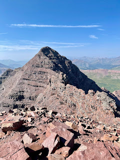
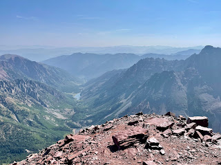
North Maroon Peak - Northeast Ridge

 Carly Kovacik and I reached the summit of North Maroon Peak via the Northeast Ridge during early/mid August. I made an attempt on this mountain nearly 10 years ago, but got cliffed out near 13,000 feet and lost the route. Carly and I didn't have that problem, as we found a weakness through the cliff bands and ledges and reached the northeast ridge. We then strolled to the 20-40 foot class 4 chimney. At first I was afraid I wouldn't be able to down climb the chimney, and was reluctant to ascend. But, I reasoned there would be a way down and thus went on up. The toughest part of the chimney was a ~5 foot stretch at the top from one side to the other...it was a bit un-nerving due to the amount of air below my body, but otherwise completely doable. 

 The remainder of the route to the summit involved a walk across the precipice, which was admittedly awesome and exhilarating being next to such a profound drop-off. Then, the final push up the last couple hundred feet of the mountain involved additional ledge traversing and slogging up loose rock and dirt. Carly and I reached the top in 6 hours. We soaked in the views from the summit and then began the grueling descent. I lowered myself down the top part of the chimney to a ledge 5 or 6 feet below the rim, and then made easy work down the rest of the crux. Thereafter, the remainder of the descent was generally miserable due to the steepness of the route and the loose nature of the rock. We made our way down gulley number 2, then traversed to gully number 1, then traversed to the rock glacier, and finally began to relax as we made our way to the tourist trail. Our elapsed car-to-summit-to-car time was 12 hours.

YouTube video is here: [https://www.youtube.com/watch?v=Nj7_qaL993Q]. Google map location is here.


Storm Chase//October 30, 2024//Northwest Oklahoma

 I drove out to Northwest Oklahoma to chase what appeared to be, at least initially, a favorable setup for tornadic supercells. Convective m...