Tuesday, February 15, 2022

Rhyolite, NV/Titus Canyon/Ubehebe Crater - Death Valley National Park

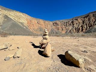
 Carly Kovacik and myself checked out the ruins of Rhyolite, NV during early February. Rhyolite is a ghost town located between Death Valley and Beatty, NV...I've explored it once before during 2015. Not much has changed, but it is a fun escape back into history and the Wild West. After Rhyolite we drove through Titus Canyon, and then after descending back into Death Valley, we headed north to Ubehebe Crater. We descended hundreds of feet into the bowels of the maar, and then slogged our way back up to the crater rim. That was followed by a scenic trip around the periphery of the crater, as well as a few sub-craters. 

Google map location for Rhyolite, NV is here; Titus Canyon here; Ubehebe Crater here.


Saturday, February 12, 2022

Mesquite Flat Sand Dunes/Gower Gulch&Red Cathedral&Golden Canyon/Evening Vistas - Death Valley National Park

 Carly Kovacik and myself woke up a few hours before sunrise during early February and trekked deep into the Mesquite Flat Sand Dunes. We made it to the tallest sand dune, which we named Mount Sandy, just as the sun rose above the eastern mountains of Death Valley. We took our obligatory sunrise sand dune pictures, and also got some video of a guy sand-boarding down Mount Sandy. After our sand dune adventure we headed south and hiked Gower Gulch to Zabriskie Point. We then did the ridge that traverses across the top of Red Cathedral. It was a fun airy trek above the Badlands, and we hoped we could find a route back down to Golden Canyon, but no such luck. So we backtracked a few miles, descended from Zabriskie, and then meandered through Golden Canyon back to the trailhead. Carly and I ended the day driving 50 miles to the east side of the Sierra Nevada Mountains, and then drove back into Death Valley and caught the mountain shadows creeping across the valley at sunset.

YouTube vide is here. Google map location is here (sand dunes), and here (Gower Gulch/Cathedral/Canyon).


Thursday, February 10, 2022

Telescope Peak - Death Valley

 Carly Kovacik and myself ascended the ultra-prominent Telescope Peak located in Death Valley during early February. We started hiking from the Wildrose Charcoal Kilns, since the road beyond that point was closed for the winter season due to ice and snow. We hiked steeply to Mahogany Flats Campground, and then transitioned to a more gently sloped traverse along the east side of Rogers Peak. However, the traverse involved multiple snow sections that would involve a very long slide down the mountain if one of us lost our footing. Thankfully our footing was sure, and the terrain became less sketchy after we left Rogers Peak behind us. We then bypassed Bennett Peak, which was followed by the final half mile up a very steep ridge that led to the summit of Telescope. Snow was generally firm the entire way up the ridge, but once again, a fall could be potentially bad, especially during the final hundred feet of ridge-climbing. 

After reaching a minor false summit, we hiked an additional couple hundred yards to the true summit of Telescope. The sky was completely cloudless, and the views of Death Valley 11,000 feet below our feet were fantastic, as were the views of the Sierra Nevada Mountains to our west. After a short brisk windy break on the summit, Carly and I departed back down the mountain. Total trip time was 9 hours exactly, mileage was around 14, and the vertical ascent was ~5,000 feet.

YouTube video is here. Google map location is here.


Thursday, February 03, 2022

Superstition Mountains - Arizona

 I took advantage of a four-day break from work and booked a flight to Phoenix, AZ for a quick hike in the Superstition Mountains. I did around 13 miles down the First Water, Second Water, and then Boulder Trails. I trekked past Battleship Mountain and then ascended a steep lonely volcanic butte that overlooked a stream valley and the distant towering Weavers Needle. This group of mountains located east of Phoenix offer some really pristine desert hiking full of rugged views, gigantic saguaro, wildlife, and a bit of scrambling for those looking for an added challenge in their hike. Definitely worth a return trip for future in-depth exploration.

Google map location is here.


Loess Hills State Forest//Hamilton County, Iowa

 Loess Hills State Forest - Hamilton County, Iowa.