I took on a photography mission to capture Thor's Well on October 30th. Unfortunately, optimal Thor's Well conditions occur at high tide...more specifically a high tide ranging from around 5 to 7 feet. Furthermore, for long-exposure shots those conditions have to be met as the sky gets dark. That criteria wouldn't occur until 2am, which was okay, because the moon was nearly full, so there would be light illuminating the scene. On the way from Eureka to Yachats, Oregon...the town near Thor's Well, I stopped in Brookings, OR and got a nice long-exposure of water flowing around a rock outcrop at sunrise. I also worked the Devil's Churn area near Cape Perpetua during the sunset hours. I messed around a bit too much and didn't get a good shot until just after the sun set. The colors in the sky and leading lines in the water were great. I then got a few hours of sleep in Yachats, woke up right before midnight, and drove out to Thor's Well. Navigating the sharp lava rock and pools of water by moonlight was not easy (my feet got very wet), but I managed. I then worked the Well for a few hours and got a couple of keepers. Those pictures and other seascapes are posted here.
Tuesday, October 31, 2023
Sunday, October 29, 2023
Golden Gate Photography Tour
I hit a couple of classic locations for photographing the Golden Gate Bridge during late October. The first site was at Marshall's Beach. I departed for the beach at 2 AM from a hotel in Petaluma, and encountered a series of sketchy experiences, starting with running over a large object on the 101 at freeway speeds. That was followed by parking at the Golden Gate Overlook parking lot, which featured a large sign warning of smash and grab activity in the lot. That was on my mind the whole morning. Next, I attempted to down climb a 100 foot sea cliff to get to the beach. I ran into a large drop-off that disappeared into darkness. I decided to turn around and go look for a proper trail...which I did eventually find. I then realized I was in the dark and mountain lions probably occasionally roam this stretch of urban wilderness. Next I reached my photography site on the beach, and had to set up shop on an outcrop of rocks in order to avoid the building high tide. Finally, this site is just a mile or so from the epicenter of the 1906 San Francisco earthquake, which created a funny kind of feeling. Otherwise, I got some great pictures of the bridge as dawn light spread across the Golden Gate terrain passage.
The next photography site I hit was a place called Slacker Ridge//Slacker Hill. It sits high above the Marin Headlands on the north side of the Golden Gate, and has an expansive view of the San Francisco Bay and downtown area. I took a series of images as the sun set, and was particularly happy with images that captured car streaks weaving around the hills below. Finally, I came for sunrise photography at Battery Spencer, which is a point located right next to the bridge, thus providing dramatic up-close photography opportunities. Unfortunately, fog was thickening around the bridge, which would block a view of the rising sun. I thus decided to take a few pictures during the late night, and then head back home to Eureka.
Some of the pictures discussed in this post can be found here.
Photography Website
I've started developing a photography portfolio that you can check out here. I'm particularly happy with the cityscape photography in the portfolio featuring the Golden Gate Bridge.
Saturday, October 14, 2023
Baker Beach Seascapes - Trinidad, California
A couple of test shots from my new Canon EOS R5 at Baker Beach near Trinidad, California. Cloudy skies made for poor lighting, but I tried to make the best of it. The length of time to expose incoming waves was particularly tricky, since a longer exposure would blow out the whites, while a short exposure would yield an image that was too dark due to cloudy skies. Otherwise, it was a fun evening next to the surf zone, and I managed to avoid getting too wet.
Location of Baker Beach is here.
Pyramid Peak - Sierra Nevada Mountains
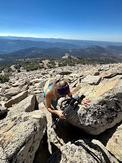
Amy Schreiber and myself had a great time on Pyramid Peak during early October. The trail was steep on the way up, at least in sections, but wasn't too terribly bad. The terrain opened up about halfway through the ascent, and we had some fun scrambling on those Sierra Nevada granite slabs. The final section to the summit was also an enjoyably sustained section of boulders. Views from the top were nice but not spectacular...I did like looking down upon Desolation Valley and Lake Aloha. We then descended back to Highway 50, cleaned up, and followed that with a dinner in Placerville at the Bricks Eats & Drinks.
Map of Pyramid Peak is here.
In Search of Original Prairie // Little Bend, South Dakota
I traveled from Omaha, Nebraska to Little Bend, South Dakota during early October to experience the prairie as the buffalo and first nation...

-
After working a midnight shift, I slept 3-4 hours, woke up at 130 pm, did a data check, dropped off a rent check, and then headed north on ...
-
I hiked 1.5 miles up to Strawberry Rock, a sea stack that has risen high above the ocean due to tectonic processes, which is located near th...
-
The following pictures were taken south of El Reno, OK, a hundred or so yards east of the intersection of Reuters and Radio Road. The TWIS...


