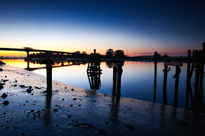
Loess Hills State Forest - Hamilton County, Iowa.
Monday, December 09, 2024
Sunday, November 24, 2024
Landscapes from California and Arizona
 |
| Trinidad, California. |
 |
| Trinidad, California. |
 |
| Sedona, Arizona. |
 |
| Eureka, California. |
 |
| San Francisco, California. |
 |
| Wupatki Ruins, Northern Arizona. |
 |
| Trinidad, California. |
 |
| Trinidad, California. |
 |
| Trinidad, California. |
 |
| Eureka, California. |
 |
| Trinidad, California. |
 |
| Wupatki Ruins, Northern Arizona. |
 |
| Trinidad, California. |
 |
| Trinidad, California. |
Thursday, November 21, 2024
Wednesday, November 20, 2024
Landscapes from Middle and Western America
 |
| Wupatki National Monument, Arizona. |
 |
| Humboldt Bay, California. |
 |
| Eureka, California. |
 |
| Trinidad, California. |
 |
| San Francisco, California. |
 |
| Rural Ohio. |
 |
| Humboldt Bay, California. |
 |
| Omaha, Nebraska. |
 |
| Omaha, Nebraska. |
 |
| Brookings, Oregon. |
 |
| Cape Mendociono, California. |
 |
| Brookings, Oregon. |
 |
| Eureka, California. |
 |
| Eureka, California. |
 |
| Eureka, California. |
Saturday, November 16, 2024
Landscape Photography//Random Scenes from across the USA
 |
| Downtown Omaha, Nebraska. |
 |
| Humboldt County coastline near Trinidad, California. |
 |
| Sedona, Arizona. |
 |
| Humboldt Bay, California. |
 |
| Downtown Omaha, Nebraska. |
 |
| Downtown Omaha, Nebraska. |
 |
| Humboldt Bay, California. |
 |
| Humboldt Bay, California. |
 |
| Coastal Oregon. |
 |
| The Golden Gate Bridge, San Francisco, California. |
 |
| Coastal Humboldt County, California. |
 |
| The Golden Gate Bridge, San Francisco, California. |
 |
| Indiana waterfall. |
 |
| Trinidad, California. |
Thursday, October 31, 2024
Storm Chase//October 30, 2024//Northwest Oklahoma
I drove out to Northwest Oklahoma to chase what appeared to be, at least initially, a favorable setup for tornadic supercells. Convective mode dashed all hope of a tornado outbreak due to strong linear forcing along a cold front and dryline occurring beneath the right entrance region of an upper-level jet. In addition, strong-gusty southerly surface winds dramatically reduced the amount of shear in the 0-1 km AGL layer, which precluded robust low-level mesocyclone development. I was left with a bunch of mainly outflow dominant pseudo-cell activity that was fun to core sample but ultimately left me less than satisfied given the long drive I made to partake in the weather event. I also got to test my tornado pathlength/duration algorithm firsthand. Predicted values were upwards of a pathlength around 20 km along the OK/KS border south of Wichita, but fell to zero at the point of initiation in western Oklahoma due to the lack of low-level shear. Storms just couldn't stay cellular far enough east to experience the stronger low-level shear.
Quandary Peak // New Years Eve 14'er // Colorado
I picked an easy access 14'er to ascend on New Years Eve, Quandary Peak, which is also perhaps the easiest of all the Colorado 14'e...

-
After working a midnight shift, I slept 3-4 hours, woke up at 130 pm, did a data check, dropped off a rent check, and then headed north on ...
-
I hiked 1.5 miles up to Strawberry Rock, a sea stack that has risen high above the ocean due to tectonic processes, which is located near th...
-
The following pictures were taken south of El Reno, OK, a hundred or so yards east of the intersection of Reuters and Radio Road. The TWIS...


