On May 17th, I hiked 2 miles north from Shelter Cove, CA, and then headed 1500 feet up into the King Range over the course of an additional two-or-so miles. This is a really beautiful hike. Waves are constantly crashing along the coast; 4000 foot mountains rise straight up out of the sea on the northern horizon; and the ascent up into the hills is within lush forest, cascading streams, and a deep gorge dropping steeply off to the side of the trail. On my return to Shelter Cove, I investigated the San Andreas Fault, which the USGS shows running approximately through the Black Sand Beach parking area. Apparently the fault ruptured in this area during the 1906 San Francisco Earthquake. There is clearly a change in rock type across the fault zone. I could only imagine what it would be like to stand on that beach during a future quake.
Friday, May 17, 2019
Thursday, May 16, 2019
Early May - Trinidad and Arcata Marsh
Saturday, May 11, 2019
Salmon Mountain - Mid Spring 2019
This is the third time I've hiked Salmon Mountain--once every year I've lived in California. However, today was the first time I did the mountain when it was loaded with snow. Actually, most of the lower slopes have melted off by this point...though I did have to hike a quarter mile up the road leading to the trailhead due to random four foot drifts covering the route--I wasn't going to chance it even in a truck with 4-wheel drive.
The standard route to the summit wraps around the west side of the mountain, then ascends up the broad south face, followed by a traverse along a narrow ridge to the summit. However, I lost the trail during the last mile of the hike due to deepening snow, and ended up following the north ridge that leads to the summit. It was steep; loaded with deep firm snow; and included a few moves over rock outcrops--but the views from the ridge leading to the summit were great...lot's of air immediately to the left of my feet. The day was glorious; the sun was blazing; Mount Shasta dominated the eastern horizon; and the Klamath Mountains were all decked in late season snow. Pictures are below:
Tuesday, April 23, 2019
Guthrie Creek Geology Part II - Russ Fault Zone
I penetrated deeper towards ground zero of the Russ Fault, which is positioned south of Guthrie Creek and north of Cape Mendocino. Unfortunately, I reached a point along the beach where cliffs rise straight out of the surf zone--the surf was too rough to walk around this point, so I will have to come back during the summer when the sea is flat and the tide is low if I want to reach the true location of the fault. Nevertheless, the geology on display became progressively more extreme the farther south I hiked along the beach. Massive--as in hundreds of feet massive--blocks of hardened clayish stone have been thrusted high above the beach. These giant blocks of earth are likely being steeply thrusted upwards in response to their close proximity to the Cascadia Subduction Zone, Mendocino Fault Zone, and San Andreas Fault. This area usually experiences an earthquake, on the order of magnitude 4 or 5, every one to three months. Like anyone else, I enjoy a good earthquake from time to time. However, I was climbing over pieces of crust that clearly had been thrusted up out of the ground during the recent geological past. Thus, fearing that the 30 year return interval for a M6.0-M7.0 might verify that second, I believe I was probably muttering under my breath "not now, not now, not now."...definitely an eerie feeling knowing that I could be knocked up into the air any second if the Earth decided to move.
See the pictures below for some extreme examples of anticline folding and steeply angled blocks of earth, all of which dip toward the north.
Wednesday, April 17, 2019
Coast Guard Field Training Exercise
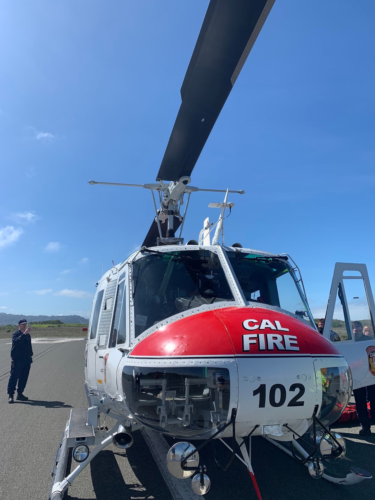
My NWS Eureka colleagues and I attended a Coast Guard Field Training Exercise on April 17, 2019 at the Samoa Airport west of Eureka, CA. We arrived at 8 am, watched Coast Guard, California Highway Patrol, and CalFire helicopters land; and then proceeded through a field training briefing, in which I gave a weather summary for all the participants. The highlight of the exercise was watching the Coast Guard helicopter team retrieve mock injured parties from the ground via assistance from local firefighters, who participated in order to familiarize themselves with helicopter assisted rescue operations.
Sunday, April 14, 2019
Guthrie Creek Geology
The beach leading south from Guthrie Creek, which is accessed via a steep trail located off of Centerville Road in Humboldt County CA, displays incredible evidence of thrust faulting. Gigantic slabs of sand-stone'ish material have been thrusted hundreds of feet into the air. And the erosive wave action from the ocean hasn't had time to break these huge blocks of solid sand down even though the upwarped material extends straight up out of the ocean's edge. There are several thrust faults running more or less east-southeast to west-northwest, parallel to the nearby San Andreas Fault to the south. At low tide I hope to travel farther south along the beach and explore the remainder of this geologically active portion of Humboldt County.
| Giants slabs of solidified sand are being thrusted upwards at a steep angle near Guthrie Creek. |
![]() |
| Looking south toward Cape Mendocino and the Mendocino Triple Junction, where the San Andreas Fault, the Cascadia Subduction Zone, and the Mendocino Fault Zone all converge. |
| Trail south of Centerville Beach slowly sliding off into the ocean. |
![]() |
| Sand bluffs rising high above Centerville Beach. |
Subscribe to:
Posts (Atom)
Family Adventures in the Rockies // Grottos Ice Caves/Mount Sherman
My mom and nephew made a trip to central Colorado during early summer and we all had a blast hiking a couple of unique geological features,...
-
Cindy McCloskey, Ariel Cohen, Kim Klockow, and myself (Jonathan Garner) went climbing at Rocktown Gym in Oklahoma City on June 20th. The fo...
-
After working a midnight shift, I slept 3-4 hours, woke up at 130 pm, did a data check, dropped off a rent check, and then headed north on ...
-
Anca and I hit up different spots on the San Andreas Fault as we made our way south from Point Reyes to Parkfield, CA. Near Point Reyes, we ...