Sunday, April 05, 2020

Eureka to LA to Houston and Lubbock: A Funeral and Corona Observations

I flew from Eureka to LAX to Houston and then Lubbock during mid March, the beginning of the corona-craziness that has engulfed the world. I attended my grandmothers funeral in Lubbock. Few could attend due to fear of contagion, but it was still a great ceremony, and was attended virtually by many thanks to streaming video. My grandmother lived 98 long years...through a world war, a Great Depression, a moon landing, Vietnam, Generation X, and now the Millinneals. She was a strong woman, kind, sharp, observant, and wrote wonderful letters. She will be missed, but also celebrated.

The sequence of flights to Lubbock were nearly void of passengers. LAX was actually a joy to experience thanks to the lack of people. Houston Intercontinental was similarly pleasant. I had good views of Los Angles going to and from Texas. A few pictures of downtown LA, and SoFi Stadium are posted as well. 

Downtown Los Angeles.
An empty flight to Los Angles due to corona fear.
The Salton Sea; the southern terminus of the San Andreas Fault.
Lubbock, Texas.
The Guadalupe Mountains; highest point in Texas.
South-Central Los Angeles.
The new LA Rams stadium under construction, and the famous LA Forum center-left.

Wednesday, January 01, 2020

Death Valley: Marble Canyon

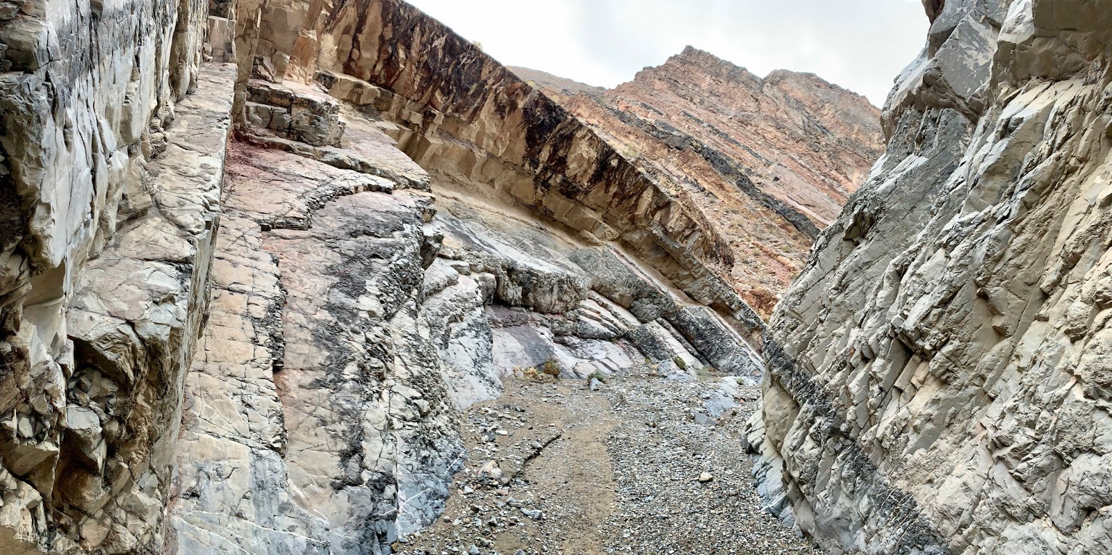
My mom and I tackled a very rough Cottonwood Canyon Road during late December, reaching the mouth of a valley that yields access (eventually) to Marble Canyon. We parked and hiked 4 miles to the entrance to Marble, and then hiked an additional 1-2 miles into the canyon. The highlight of the canyon is a section of solid slick-rock marble walls that have been eroded by countless floods into smooth ghost-like shapes. Otherwise, it was a typical Death Valley canyon. If you have 4WD, go all the way to the trailhead and don't stop short, otherwise you will have a very long hike that is rewarded by only 1-2 miles of interesting canyon hiking.

Death Valley: Mesquite Flat Sand Dunes

I backcountry hiked from Stovepipe Wells to Mesquite Flat Sand Dunes during a cloudy and occasionally rainy late December day in Death Valley. I spent countless hours photographing the intricate patterns formed in the sands and clays and dunes and vegetation of the desert. The grand vistas were undoubtedly impressive, but I came to a greater appreciation when examining the finer details of my surroundings. After the dunes, I drove east on highway 374 and viewed the sunset from a vantage point of 3000-5000 feet above the Valley.

Intricate sand and clay formations at Mesquite Flat Sand Dunes, Death Valley, CA.
Sand/clay formations at Mesquite Flat Sand Dunes, Death Valley, CA.
Mesquite Flat Sand Dunes, Death Valley, CA.
View from Daylight Pass Road and Beatty Road, Death Valley, CA.

Death Valley: Sidewinder Canyon Slots

I guided my mom through the slot canyons that branch off from Sidewinder Canyon. There were a few dry falls that she couldn't climb. The ones she didn't tackle, I made up, and actually followed one slot hundreds of feet up to the top of a ridge that gave me a great view of the Canyon and Valley of Death below.

Sidewinder Canyon slot, dry fall cliff, Death Valley, CA.
One of many slot canyons branching off from Sidewinder Canyon in Death Valley, CA.
Slot canyon, Sidewinder Canyon, Death Valley, CA.
Slot Canyon, Sidewinder Canyon, Death Valley, CA.

Death Valley: Gowler Gulch, Zabriskie Point, Golden Canyon, Titus Canyon Road

I re-hiked the Gowler Gulch to Zabriskie Point to Golden Canyon loop with my mom during late December 2019. This hike never gets old, especially the section leading from Zabriskie to Golden Canyon. After that hike, we drove across the Nevada state line and then turned onto the Titus Canyon Road. This one-way drive led us on a 27 mile adventure through rugged canyon scenery. I had a truck and didn't experience any problems with the road, but a low clearance vehicle might right into issues. We then enjoyed the sunset as we exited the canyon and headed back to Stovepipe Wells.

Zabriskie Point, Death Valley, CA.
Approaching Manly Beacon.
Manly Beacon.
Manly Beacon.
Beatty Road, Death Valley, CA.
Red Pass, Titus Canyon Road, Death Valley, CA.
Titus Canyon, Death Valley, CA.
Titus Canyon Road, Death Valley, CA.
Scotty's Castle Road, Death Valley, CA.

Death Valley: Badwater Basin

I drove from Bakersfield, CA to Death Valley for a Christmas week of hiking with my mom. This is the third time I've been to Death Valley, but I was glad to revisit all the highlights with her. Our first stop was Badwater Basin, which is the lowest point in North America at 279 feet below sea level. Interestingly, the center of the basin was filled with a thin layer of water due to recent rains, laying on top of hard thick crusts of salt.

Boardwalk that leads to the Badwater Basin salt trail.
Badwater Basin, Death Valley, CA.

Family Adventures in the Rockies // Grottos Ice Caves/Mount Sherman

 My mom and nephew made a trip to central Colorado during early summer and we all had a blast hiking a couple of unique geological features,...