Pictures posted below are from 14 April 2012. CNN went live from the Storm Prediction Center on an hourly basis, updating viewers on the evolving tornado outbreak over the central and southern plains. Steve Weiss had a starring role in these live broadcasts.
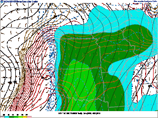
Meteorological data below the CNN pictures highlights a few environmental features present during this outbreak. The large-scale pattern featured an upper trough over the southwestern CONUS, with a strong upper-level jet spreading downstream into the Great Plains. This induced cyclogenesis over the high plains, favoring the development of a southerly low-level jet from Texas into Kansas, and aided in establishing a broad moist/unstable warm sector east of the surface dryline. This setting is fairly typical of Great Plains tornado outbreaks. Initially, forecasters believed a substantial tornado threat would develop along the warm front lifting into Nebraska. However, late morning/early afternoon thunderstorms lifted northward across the warm front into Nebraska, and stabilized the airmass, which substantially reduced the potential for tornadoes.
Meanwhile, discrete/isolated supercells developed along the dryline over northwestern Oklahoma and southwestern Kansas. These long-lived storms moved northwest across the region, but struggled to produced tornadoes initially. Near sunset, the low-level jet strengthened to near 70 kt, which dramatically increased low-level vertical wind shear. In addition, the thermodynamic environment continued to favor surface based supercells. The RUC proximity sounding from KEND in northern Oklahoma shows a potent combination of shear and instability present across the area during the early night, with MLCAPE values at or above 2000 J/kg, minimal CINH, and effective SRH values exceeding 700 m2 s-2. Supercells which had been marginal tornado producers during the afternoon suddenly experienced a rapid increase in low-level updraft rotation, resulting in strong to violent tornadoes.
Subscribe to:
Post Comments (Atom)
Mount Sherman // West Side Leadville Route
I summited the ultra-easy Mount Sherman from the west Leadville side/Iowa Gulch trailhead. That trail starts at 12,000 feet, which made thi...

-
After working a midnight shift, I slept 3-4 hours, woke up at 130 pm, did a data check, dropped off a rent check, and then headed north on ...
-
The following pictures were taken south of El Reno, OK, a hundred or so yards east of the intersection of Reuters and Radio Road. The TWIS...
-
I hiked 1.5 miles up to Strawberry Rock, a sea stack that has risen high above the ocean due to tectonic processes, which is located near th...


No comments:
Post a Comment