


Carly Kovacik and I summited Mount Adams (12,276 feet) on September 10th. The climb began at 3 am, and was initially characterized by a leisurely stroll through a forest of mainly dead trees, a few of which were strewn across the trail due to a recent wind storm. After the forest, we then ascended up a shoulder of Adams, gradually encountering increasingly rocky terrain. Sunrise greeted us as we reached the first of several glaciers. At the first glacier, we looked back to our south and witnessed Mount Hood catching the first rays of daylight, while the low-lands below were blanketed in dark thick smoke.
We put on micro-spikes and moved up our first glacier traverse, which was followed by a climb over a moraine, and then a second glacial traverse. We then reached the Lunch Counter, which was pocketed by a smattering of tents sheltering people who were likely smarter than Carly and I since they broke up Adams into a two day ascent. After moving past the Lunch Counter, a much steeper glacier lay in front of us. We switch backed up this glacier, using a bit more caution than the last glacier due to our use of tiny micro-spikes on steep ice. We finally reached the top of the glacier and encountered the most grueling portion of the climb...a steep rocky ash covered slope that led to Pikers Peak. There were times when each step up sent us sliding back down five feet. It was a miserable experience, but we got past it, eventually. We then had a bit of flat terrain on Pikers Peak that led to another flat glacial traverse that was followed by the final pitch up Adams. This last pitch was steep, but the footing was not bad, and before we knew it, we were at the summit.
There is an old hut at the top of Adams...perhaps a fire lookout? Otherwise, we had clear views of Rainier, Baker, Saint Helens, and Hood. Even better, there was no wind at the top and the air was mild. We relaxed for a bit at the summit and then began the long arduous descent. It was a killer on my feet and knees. There were a few falls here or there, including a tumble on a glacier. Otherwise, the down-climb was uneventful, albeit pure misery. We finally got back to the trailhead at around 6 pm. Fifteen hours of hiking, 14000 feet up and down over a horizontal distance of about 12 miles. I'm glad I got this summit, but I'm not sure I'll ever be back, at least not to attempt summiting in one day.
Google map location is here.


Carly Kovacik and I did a large loop through Lava Canyon near Mount Saint Helens on September 9th. Initially the hike seemed to be a dud. I had read about a ledge system that had to be traversed followed by a ladder that had to be used to move through a lava cliff. However, we didn't see any sign of those features as we explored the first mile of trail. We then back-tracked to a viewpoint above a waterfall, and that's when I noticed a second section of trail that spurs away from the main part of the park and leads to the lower falls of Lava Canyon. Carly and I took off down this trail and it became sketchy quickly. The dirt path was very narrow, perhaps around a foot wide at points, and it was composed of loose dust and gravel that slopped downward toward a terrifying abyss. I looked off towards the abyss once and felt primal fear being one step away from death. Still, I forced myself forward, focusing intently on each step.
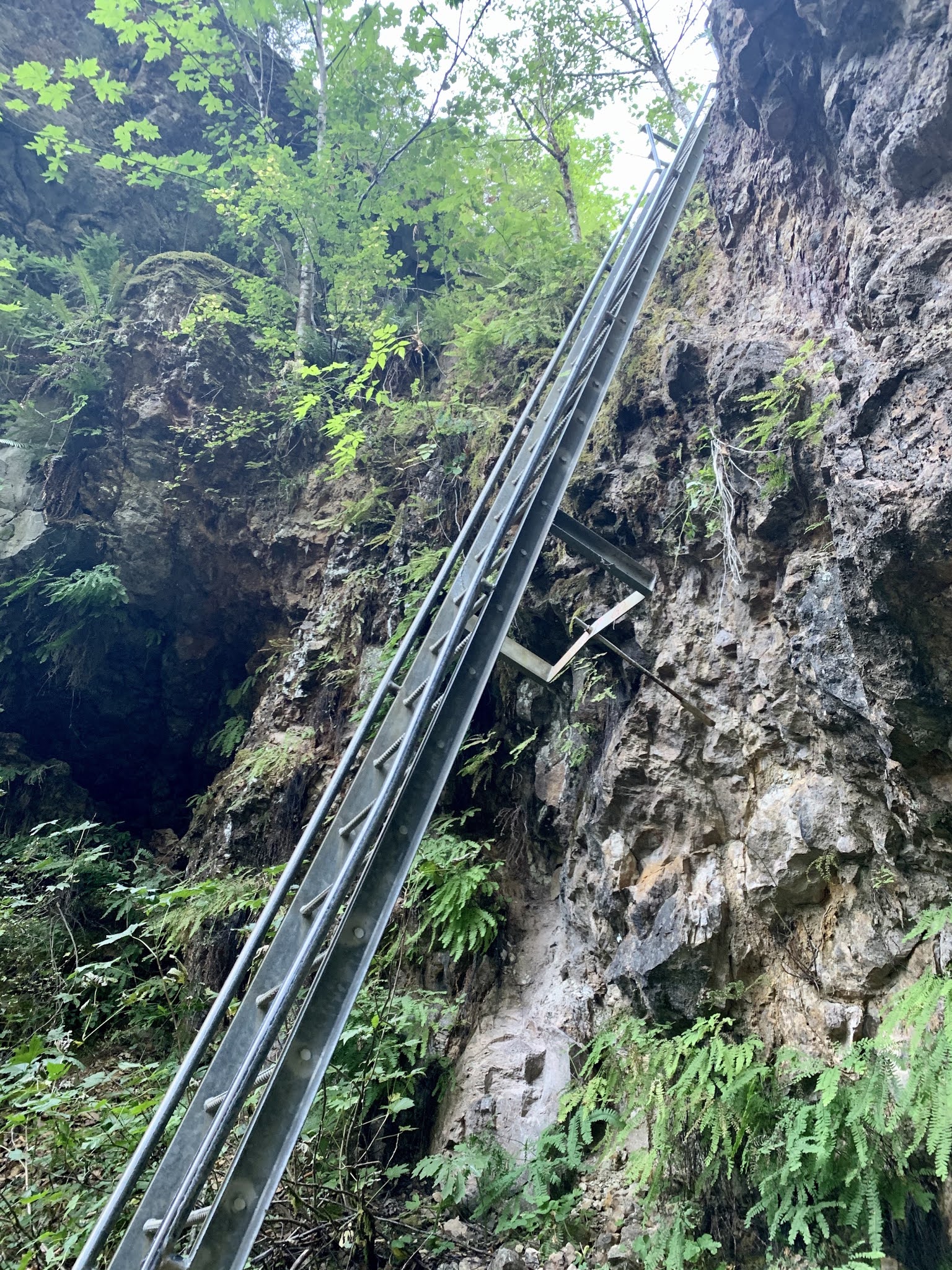
The trail continued descending down toward the bottom lower portion of the lava canyon, and the sketchy sections became less frequent. Nevertheless, one more obstacle lay ahead...a 30 foot drop down the face of a lava cliff via a sturdy ladder. Carly climbed down first, and I followed, again feeling un-nerved as I extended my body out into the void. After the ladder section, we walked across a bridge to the other side of the river that led to a trail that followed along cliffs. We hoped that trail would lead back to the main part of the park, but no luck. We back-tracked and I used my GPS watch to locate a long loop that affirmatively led back to the parking lot. We took that trail, which was probably 4-6 miles long and ascended a 1500 foot hill back to the trailhead.
Google map location is here.


I woke up on Tuesday September 8th looking out the window and seeing something strange. Thick plumes of smoke were moving fast and low across the southern horizon--one ridge away from Cougar, Washington. A wildfire blew up overnight near Carson, Washington...luckily for me it was too far south to pose a threat of overtaking my location during the night, but the threat of the fire spreading downstream across Cougar later in the day didn't seem implausible. So Carly Kovacik and myself packed up our possessions and we both drove our vehicles to Climbers Bivouac south of Mount Saint Helens. We had purchased climbing permits for this date back in March, and it turns out it was one of the biggest easterly offshore wind events of the year. Go figure.
From Climbers Bivouac, Carly and I made quick work of the trail leading to treeline. After exiting treeline the wind immediately picked up, and as we began climbing up towards Monitor Ridge, gusts began to knock us off balance and volcanic dirt flew into our eyes, face, mouth, and any other uncovered parts of our bodies. It would have been easy to quit at this point due to the wind, but neither of us uttered any such words, so onward and upward we went.
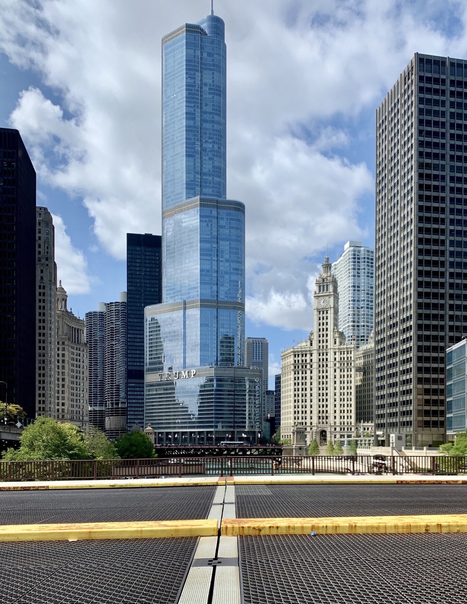
As we entered the upper slopes of Saint Helens, portions of the trail that went across small saddle shaped gaps were particularly prone to intense sustained winds. At times I estimated wind speeds were between 70 and 100 mph. I would be stopped dead in my tracks, occasionally being nearly knocked over. Carly admitted she was toppled a few times. The sound of the wind shredding my jacket like a rapidly firing automatic machine gun was something I got used to during much of the ascent. But it was the constant irritation of being pelted with BB size pieces of dust, dirt, and rock that made this climb a truly miserable experience. Nevertheless, we summited, and thankfully, strangely, the wind was calmer at the rim of the volcano. The sky was filled with dust and wildfire smoke, but we still had a good view of the rebuilding volcanic dome and growing glacier below our feet. Mount Rainier was prominent on the horizon as well. We then had an uneventful descent, besides the battle with the wind, and celebrated our summit at Barrel Mountain Brewery in Battle Ground, Washington.
Google map location is here.


After two failed attempts to summit Mount Yale, once due to heavy snow, and a second due to hurricane force winds, I finally made it to the...


