Friday, July 31, 2020
Aspen Mountain
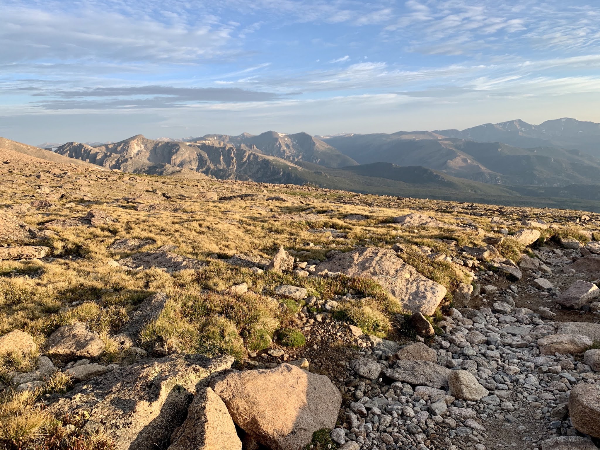
Carly and I decided to ascend Aspen Mountain, the location of the ski slopes bounding the south side of Aspen. This hike involved an elevation gain of 3,000+ feet over a distance of 4+ miles. The ascent was non-stop unrelenting uphill; much much harder than the 14'er Bierstadt I did the day before. Unfortunately, we hit a downhill section on the gravel road we were following, and my feet slipped out beneath me. I caught my fall with my hands, and blood started gushing out of my palms. Clotting set in soon after and we continued our ascent upwards. Finally, after about 3 hours, we reached the top, and thunderstorms were quickly approaching. We tagged the summit and then got a beer in the ski lodge located at the top of the mountain. We then decided to beat the approaching storms downhill by taking a ski resort gondola back into Aspen.


Bierstadt-Sawtooth-Evans Traverse
Carly and I summited Mount Bierstadt (14,065 feet) and Mount Evans (14.265 feet) on July 30th, connecting the two via The Sawtooth. We reached the Guanella Pass Trailhead at 3:15 am and began hiking up the shoulder of Bierstadt almost immediately. The star filled sky was nice to gaze at while we gained our elevation. Unfortunately, the wind became progressively stronger with time, such that we were frozen stiff when we reached the summit of Bierstadt at around 5:30 am. Carly took some pictures of the sunrise over Evans, and we briefly chatted with a few other early morning summitters. One of them, by the name of Justin, indicated he wanted to do The Sawtooth traverse, so we invited him into our group, and then off we went, beginning our down climb of The Sawtooth arete.


Although The Sawtooth may look a bit scary from afar, it was generally an enjoyable relaxing experience in my opinion. The down climb from Bierstadt involves some route finding close to the center of the arete, but usually slightly to right (south) side. Carly, Justin, and I picked our route downwards, and increased our pace as the morning sun unfroze our limbs. After we completed about two-thirds of The Sawtooth, we then began ascending toward what most would consider the crux of the route. A narrow ledge/ramp ascends up towards the northwest shoulder of Evans, and must be traversed in order to exit The Sawtooth. This ledge seemed somewhat similar to The Narrows on Longs Peak. We didn't have any issues crossing this feature, but it was filled with loose rock, and that loose rock led to a terrifying cliff that would surely end in death for anyone who slipped off. Still, it is pretty easy to find a safe route, which we did, and then found ourselves facing the ascent of Mount Evans.
We took the standard route up Evans, which involved boulder hoping on its western face, gradually ascending, and sometimes getting off route in the hope that a false summit would turn out to be a real summit. We eventually reached the top by mid to late morning; we had our summit meal and beer; took our summit pictures; and relaxed in the sun and out of the wind thanks to a couple of large summit blocks. Then, as we were preparing to pack up and descend, two fighter jets flew right over our heads, no more than a hundred feet above. It was surreal to watch that unfold, and I wish I had my phone out to record the event.
We then began the long descent back to the trailhead. We decided to forgo The Sawtooth a second time, and instead took the West Ridge of Evans to Guanella Pass. The first section mildly descended away from Evans, but then narrowed into a very steep gully that seemed to go forever. Even worse, the rock was incredibly loose and we all had our share of slips. Next, we passed a meadow with a waterfall and nice view of Bierstadt and The Sawtooth from below. The meadow transitioned into thick deep mud that we had to navigate the best we could. Willows became increasingly thick as well, and that was our life for the next hour or so. Finally, we reached the civilized Bierstadt trail, and made quick work of the remaining distance back to my truck.
Google map location is here.


Hunter Creek Trail and Aspen Hickory House
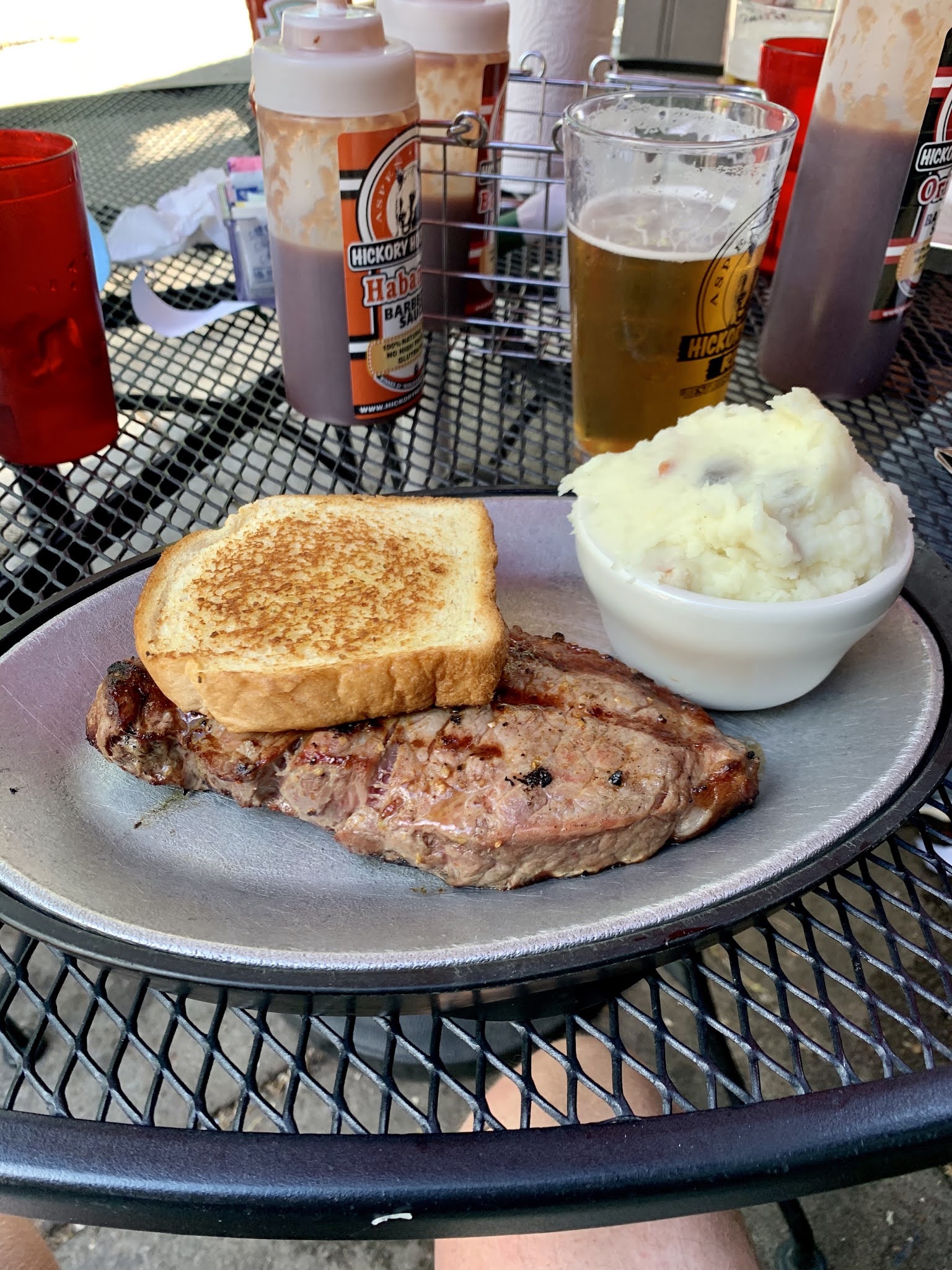
Carly and I had a down day in between 14'ers, so we decided to do the 5-6 mile long Hunter Creek Trail in Aspen, CO. The trail starts steeply, but also provides breaks at creek crossings. We eventually ended up in a meadow that was followed by another series of steep road cuts. Finally we reached the apex of the trail, which also featured a lookout platform that provided great views of Aspen, the surrounding valley, and mountains. We then descended the Lani White Trail back into Aspen. After the hike, we had a pre-14'er protein load at the Aspen Hickory House. I highly recommend this place. The outdoor seating was perfectly shaded from the late day sun, the food was outstanding, and the beer selection was fantastic.


Wednesday, July 29, 2020
Longs Peak: Confusion on the Ledges
Carly and I left Moab, Utah on July 27th and headed for our next destination, Aspen, Colorado, so that we would be in position to attempt a series of 14'ers during the following week. After a brief stop at the Rockslide Brewery in Grand Junction, Colorado (which makes an excellent sandwich called the Hot Italian), we drove an additional two hours to Aspen. On the way, we came up with the crazy scheme that we might as well head to Longs Peak that night and make a summit attempt. And that's just what we did after checking in to our Aspen hotel. Upon arrival in Boulder, Colorado, we decided to kill a bit of time at The Corner Bar. I downed a cup of chowder and then we were on the road again, ascending up Highway 7 toward the Longs Peak trailhead.


At 11:15pm on July 27th Carly and I began our uphill hike towards Longs. Hiking this trail at night always seems to go by fast. Soon, views of the Denver metro area city lights appeared, and before we knew it we were above treeline. We kept slogging upwards toward The Boulder Field, which was a nightmare to tackle in the dead of night. Finally The Keyhole came in to view...a slightly less dark feature silhouetted against a starry black background. It towered menacingly above us, and upon reaching this iconic hiking landmark, a black chasm lay beneath our feet...Glacier Gorge.
It was now around 3-4 am. We carefully began traversing along the ledge section of Longs Peak, making exposed class 2-3 moves on occasion. We then reached a section of The Ledges, which in hindsight we should have descended in order to reach The Trough. However, it was pre-dawn, and we couldn't locate the yellow-orange guide dots painted on the rocks. We searched and searched for the correct route, but we just couldn't find it. In addition, an upper-level disturbance was quickly advancing toward our area. The wind increased dramatically and clouds were rolling in. After waiting for 15 minutes in hopes of another party strolling by to serve as guides, and seeing that no one was going to come, we decided to turn around and start moving back to The Keyhole, if for nothing else than to avoid hypothermia. The mountain rejected our summit attempt this time, but we both vowed to return and finish the hike in the future.
Google map location is here.


Tuesday, July 28, 2020
Canyonlands: Gooseberry Trail; Shafer Canyon Road; plus Dead Horse Point
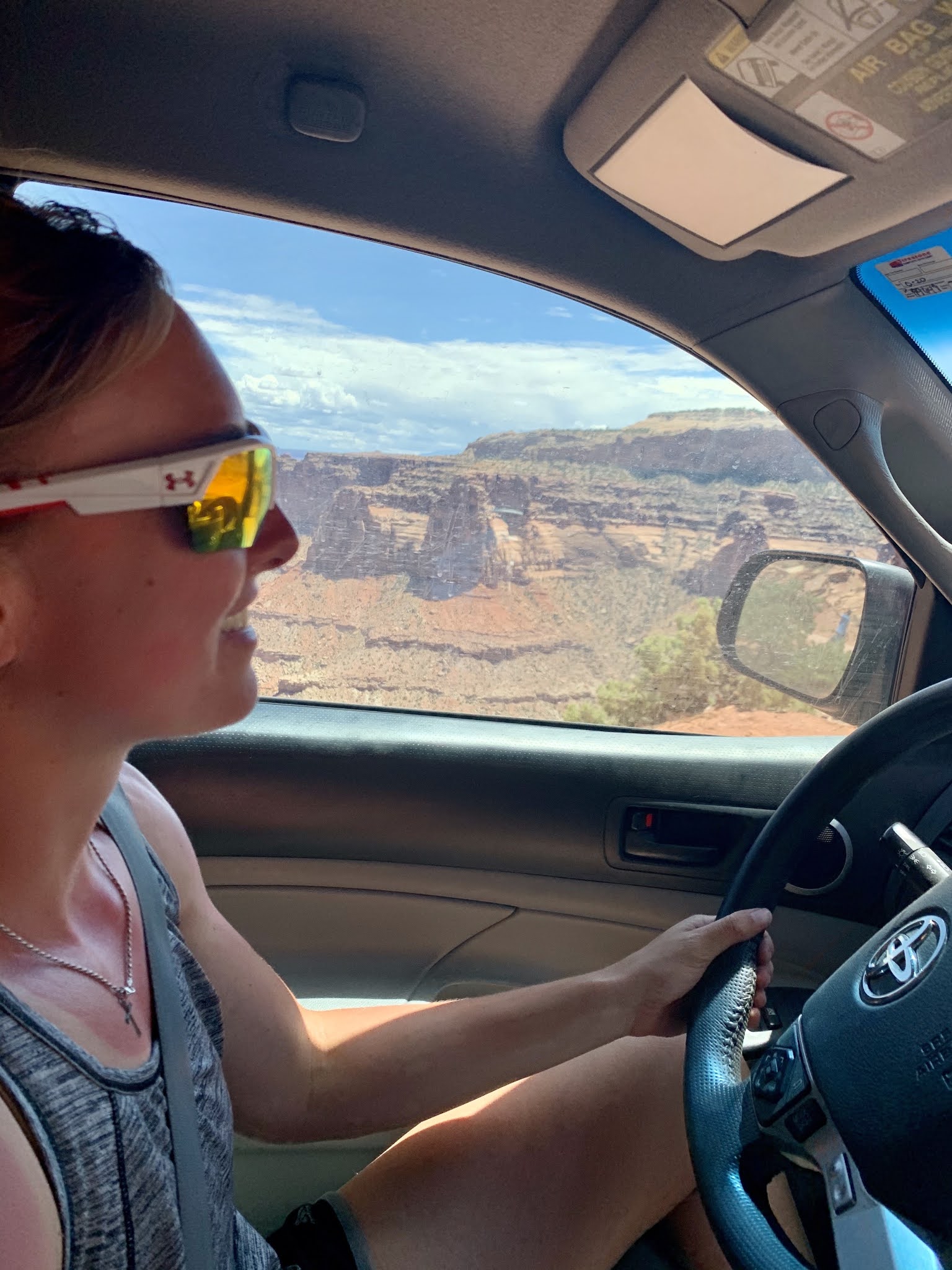
Carly and I hiked Gooseberry Trail in Canyonlands National Park during late July. The trail leading away from the trailhead parking lot quickly begins a steep descent down the side of a 1000+ foot canyon wall. There is mild exposure along the way, but nothing horrifying; and numerous switchbacks help ease the pain on the quads. At the base of the canyon headwall, the trail meanders another mile to the rim of a second tier of canyon. Carly and I re-energized next to a 100 foot drop and then made our way back towards the initial headwall. The ascent back up the canyon was grueling for me due to the heat, resulting in numerous rest-stops at every rock or tree that provided shade. However, another deadly menace lurked beneath our feet as we approached the top of the canyon. I stepped over a rock, and Carly was about to do the same, but then paused and asked me if I heard a rattle. I didn't hear it, but she insisted it was there. Carly then peered under the rock I had just stepped over and spotted a juvenile rattlesnake. We took some pictures of the rattlesnake, and then pondered how lucky we were not to be struck as we finished off the hike.


Next, after a brief stop at Mesa Arch, we descended down Shafer Canyon Road, which hugs the side of the canyon, thousands of feet above the base. I let Carly have the honors of driving this road that became progressively more treacherous with each passing mile. We made it, and my truck survived the test. Then, later in the evening, after dinner, Carly and I drove out to Dead Horse Point, watching a setting sun cast long shadows across the expansive canyons below our feet. It was a great way to end a long day of adventure.


Subscribe to:
Posts (Atom)
Peak One // Frisco, Colorado
I ascended Peak One located on the western edge of Frisco, Colorado during mid June. The route to the top was always up, with few if any pla...
