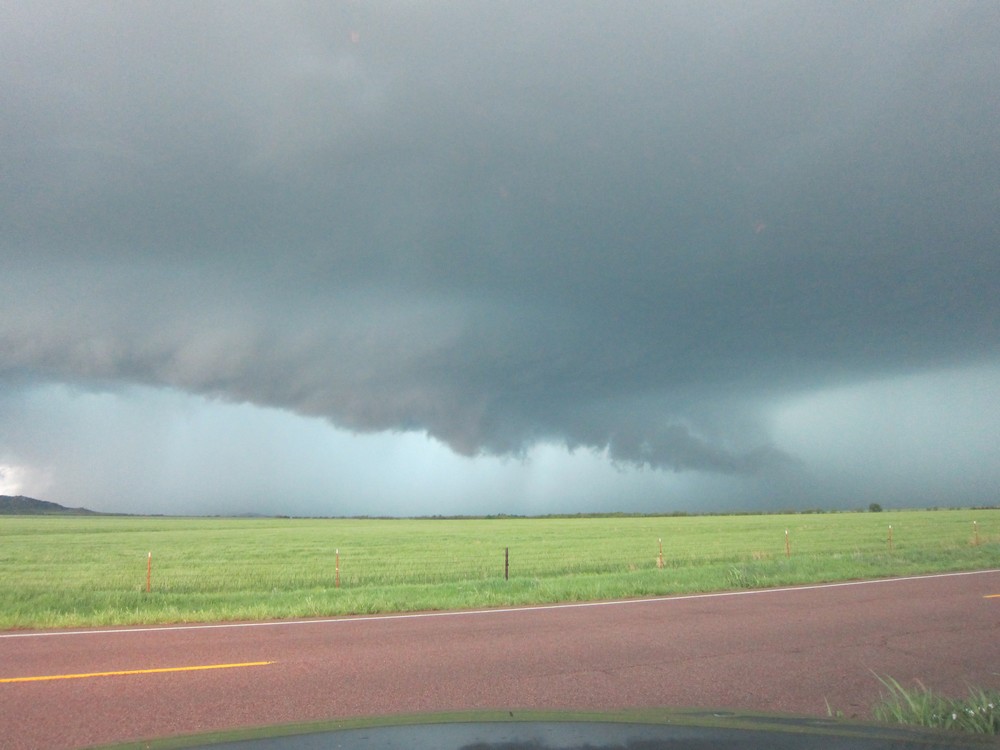
Pictures posted below are from 14 April 2012. CNN went live from the Storm Prediction Center on an hourly basis, updating viewers on the evolving tornado outbreak over the central and southern plains. Steve Weiss had a starring role in these live broadcasts.
Meteorological data below the CNN pictures highlights a few environmental features present during this outbreak. The large-scale pattern featured an upper trough over the southwestern CONUS, with a strong upper-level jet spreading downstream into the Great Plains. This induced cyclogenesis over the high plains, favoring the development of a southerly low-level jet from Texas into Kansas, and aided in establishing a broad moist/unstable warm sector east of the surface dryline. This setting is fairly typical of Great Plains tornado outbreaks. Initially, forecasters believed a substantial tornado threat would develop along the warm front lifting into Nebraska. However, late morning/early afternoon thunderstorms lifted northward across the warm front into Nebraska, and stabilized the airmass, which substantially reduced the potential for tornadoes.
Meanwhile, discrete/isolated supercells developed along the dryline over northwestern Oklahoma and southwestern Kansas. These long-lived storms moved northwest across the region, but struggled to produced tornadoes initially. Near sunset, the low-level jet strengthened to near 70 kt, which dramatically increased low-level vertical wind shear. In addition, the thermodynamic environment continued to favor surface based supercells. The RUC proximity sounding from KEND in northern Oklahoma shows a potent combination of shear and instability present across the area during the early night, with MLCAPE values at or above 2000 J/kg, minimal CINH, and effective SRH values exceeding 700 m2 s-2. Supercells which had been marginal tornado producers during the afternoon suddenly experienced a rapid increase in low-level updraft rotation, resulting in strong to violent tornadoes.
I did a day hike with my mom in Palo Duro Canyon State Park south of Amarillo, TX on Saturday 4/21. As crazy as it sounds, she actually climbed above 13,000 feet on Pikes Peak the day before, but had to turn back due to deep snow.
We decided to do the Lighthouse Trail, which is an easy 3 mile stroll that leads to the most popular canyon formation in the park (called the "Lighthouse"). Unfortunately, we made an erroneous left turn during the early stages of our hike, which added an additional four miles to our trip. This trail eventually led to a dead end, which is when we realized we made an error, so we turned around, and eventually regained the correct trail. Luckily, the high temperature was only around 80F, so our mistake wasn't too physically draining. As we approached the Lighthouse, a steep 100-200 foot cliff must be gained. The combination of loose dirt on a 50-degree slope almost made me wish I had crampons. After this crux section is finished, you are able to scramble up on top of a flat table like area of mudstone, and then scramble another 50 feet to the top of a buttress, which is adjacent to the Lighthouse.
On the way home, I decided to find out how many times I could listen to Frank Black's album Teenager of the Year between Amarillo and Oklahoma City. Averaging 70-75 mph, the answer is 3 times.
I finally saw my first Oklahoma tornadoes on Friday, April 13 2012. This was the "day before the day," characterized by an upper trough located well west of the region, with moisture returning northward into the Great Plains aiding in a tornado threat that increased near sunset as the low-level jet stream intensified. A co-worker at the SPC, lead forecaster Corey Mead, published an excellent paper on this particular type of environment, which can be found here: http://www.ejssm.org/ojs/index.php/ejssm/article/view/84/66
Of course, the nocturnal sig-tor threat didn't materialize. But, tornadoes occurred nonetheless, including a tornado that moved through Norman, OK just after I departed for southwestern Oklahoma.
I had to work a fire weather shift on this day, but was able to leave work early. I traveled west on I-40 initially, just in case convection surged north with any intensification in the LLJS. As it turned out, a supercell in southwestern OK made very little east-northeastward progress during my drive. As I drove south on highway 54, this storm came into view, and it was quite apparent that it was an HP.
I sat along the side of 54 for quite a while, unsure if the storm would move due east along highway 62, or move northeast toward my position near Cooperton, OK. I watched the storm go through a rain-wrapped mesocyclone occlusion, after which it then then moved northeast. After the initial meso occlusion, it developed a new wall cloud beneath a milky updraft (it had problems removing precipitation away from the updraft, thus its HP character). Then, a new low-level mesocyclone developed north of the established wall cloud. I drove north to a position about 1 mile southeast of this new meso, and waited patiently to see what it would do. Low-level rotation was obviously strengthening...then a rain curtain wrapped around the meso, and my view of the base was cut off. I decided to slowly move north into the edge of the hook echo. The time was now around 7:30pm. All of a sudden, I saw what appeared to be the entire updraft base at the ground, a giant cylinder emerging out of the rain. I looked northwest, and the edge of a large tornado was directly in front of me, about a quarter mile away. There was no time to take pictures. I quickly put my truck in drive and sped off to the south for about a mile. The rain curtains were rapidly swirling cyclonically around me...I felt relieved when I finally exited the hook echo. Several good YouTube videos of this tornado have been posted...here is a sample:
This tornado dissipated fairly quickly. I then followed the storm northeast. The sun set, and the LLJS was definitely cranking up. I eventually navigated through the RFD and repositioned myself along the edge of the updraft. Initially, the occluded portion of the updraft to my northwest looked favorable for another tornado. But that area got a cold look, and a new meso formed to my north-northeast. A v-shaped lowering developed, back-lit by lightning, and a brief 20-second tornado occurred. I don't have the exact time of this event, but apparently it touched down close to the town of Carnegie, OK. In addition to this tornado, it was eerily cool listening to the inflow scream through the powerlines positioned along the side of the road.
I then decided one nocturnal tornado was enough for me and ended the chase. However, the battle back home through pouring rain was hell, but I eventually made it back to Norman shortly after 11pm, and celebrated a successful chase by having a couple of beers with a few friends.
Cindy McCloskey and myself tackled Elk Mountain via the Charon's (pronounced Karen's) Garden Wilderness Trail. After taking a short side-trip up a rock buttress, we returned to the main trail, and then began ascending a gully filled with medium sized boulders located on the northwest flank of Elk Mountain. After gaining several hundred feet, we then veered south up a second gully, which gave access to an expansive slab of exposed granite that was sloped at a 30-40 degree angle. We smeared up the granite slab, and before we knew it, we reached the large flat summit. We then made a southeastward traverse across the top of Elk Mountain, and regained the class 1 trail that leads north toward the Sunset Lake picnic area and parking lot. We made a detour along a trail segment that followed a stream, reached the picnic area, turned west, and regained the Charon's Garden Trail. Halfway through the trail, we encountered the expansive boulder field that resides at the base of Elk Mountains western slope...the boulder hopping was great. Next, we skirted past a seasonal waterfall, regained the rocky trail, and reached the end of our adventure soon after. The traverse/loop was around 6 miles roundtrip, took 3 hours to complete, and the climbing didn't exceed class 3.
Less than ideal weather conditions continue to hinder my attempts to ascend peaks in Rocky Mountain National Park this winter. On 4 March, I arrived at the trail head that leads up to Flattop Mountain, with the goal of ascending Hallett Peak once again. However, just like my last attempt, a passing upper disturbance resulted in strong winds, blowing snow, and blizzard conditions above treeline. I settled on a nice hike through the snow toward Fern Lake, but didn't reach that goal because of ever deepening snow covering the remainder of the trail.
On 5 March, the upper disturbance passed east of the Front Range, but even stronger winds were forecast to occur above treeline, with gusts up to 60-70 mph. However, my goal this day was Mount Lady Washington, where snow would be packed, making whiteout conditions less likely. The hard snow packed trail leading through the Goblin's forest was totally relaxing, and I made good time to treeline. I then ran into intense head winds above treeline, but struggled forward toward the base of Lady Washington. Snowfields covered the eastern slopes of Lady W, so I secured my treking poles and broke out the ice axe. Sloging upwards through knee deep snow on a 30-40 degree slope was an incredibly time and energy consuming ordeal. To make matters worse, the rock was horrible...for every couple of feet I moved up on dry ground, I slid back about half a foot due to the loose scree that covered the slope. I felt demoralized in the fact that I was not covering much terrain due to the wind, snow and rock conditions, and my energy reserves were rapidly being depleted. Given these factors, as well as daylight slipping away, I decided to turn around near 12,800-13,000 feet, just a couple of hundred feet from the summit. Immediately upon turning around, I lost my balance on the loose rock, and slammed my knee into a boulder, while my ice axe slipped out of my hand and flew 20 feet down the mountain. I whimpered at my throbing knee for about 5 minutes, then got back up, retrieved my axe, and continued down.
Next time I attempt this mountain, I will probably approach the summit from the long northern ridge...where the slope is less steep. I discovered that my layering system works perfectly in the cold. I used a cap-3 as a base layer, a Marmot Genesis softshell, and an Arc'teryx Beta AR hardshell. The upper body stays completely warm with these layers, and a big down jacket isn't needed, thus I won't bring it next time to cut down on weight in the backpack. In addition, I tested out a pair of La Sportiva Nepal EVO GTX mountaineering boots. These things are indestructible, comfortable, and very warm. Even though I fell, I blame that on the terrible rock, not the boots. I don't think I'll ever buy another pair of mountaineering boots, La Sportiva is the real thing.
I recently attempted a hike to the summit of Hallett Peak in Rocky Mountain National Park, only to be turned back by strong winds on the northeast slope leading up to Flattop Mountain. Given the relative shelter from the wind below treeline, the weather felt mild. In addition, the path leading away from the Bear Lake parking lot was firm well packed snow. I attached snowshoes to my backpack in case deep snow was encountered, but they ended up becoming dead weight. Reaching a lookout that provides a view over Glacier Gorge and Longs Peak, exposure to the wind increased, with conditions seemingly worse above treeline, given the large plumes of snow blowing off of the Keyhole ridge.
I continued on nonetheless, but put on a balaclava and glacier glasses in anticipation of the winds I would soon encounter. Right on cue, the exit from treeline to exposed snow packed tundra was greeted with cold icy blasts blowing down from the Continental Divide. My lower and upper body were covered with layers of Cap 3 and Gore-Tex, and proved to be quite adequate in preserving warmth. In addition, a wool hat and the balaclava provided plenty of protection for my head and neck. However, the pair of First Ascent Guide Gloves were not enough protection to prevent my hands/fingers from becoming numb. In hindsight, I should have brought along a pair of heavy mitts (stupidly I left them in the truck to save weight). I also had issues with the pair of Julbo Explorer glacier glasses...moisture emanating from my balaclava combined with the cold ambient temperature led to annoying lens fog-up.
Besides a few gear issues, the combination of a steep snow packed slope exposed to the strong downslope winds made it nearly impossible to maintain upward progress. In fact, I fell down several times, sliding back down the slope in multiple awkward positions. So, hands were becoming numb (would frostnip/bite be next?), and the winds were knocking me down (and would surely be worse at the top of the Divide)...I decided the responsible thing to do was admit defeat and come back another day. The other day could have been the following one, except a blizzard was taking aim on New Mexico, the Texas Panhandle, and Kansas, which would block my return route to Oklahoma (or even worse, cause me to become stranded). I had no choice but to start driving back home after my summit attempt...this trip was an epic fail.
Having a few days off from work recently, I decided to head out to the Oklahoma Panhandle and knock off a state highpoint that was long overdue (given I've been living in this state for almost 3 years). The high point of course was Black Mesa...located in the western Oklahoma Panhandle, which is mainly high plains agricultural/ranch land that gives way to a rather expansive area of volcanic lava flows/mesas near the border of New Mexico and Colorado. Cimarron County, the geopolitical location of Black Mesa, is also known for its abundance of dinosaur bones and footprints, as well as the location of the southern branch of the Santa Fe Trail.
I arrived at the Black Mesa trailhead near sunrise, and started hiking immediately in order to fight off the cold autumn air. The first two miles of the trail are for the most part flat, which allows you to enjoy the interesting vista of plateaus and buttes. I eventually passed a heard of cows grazing next to the trail (apparently the state park also serves as ranch land)...they stared me down, somewhat pissed that someone would interrupt their morning meal. This was the crux of my hike though, and I got past unscathed. After two miles of flat hiking, the trail then begins to ascend for a mile up the side of the mesa. After the ascent, the trail levels off rapidly at the top of the mesa, with another mile to go before reaching the high point of Oklahoma. As I approached "the top," a heard of antelope ran across my horizon, stopping briefly to check me out, realizing I wasn't a predator, and then continuing on their way. After an hour and a half, I reached my destination, 4,973 feet above sea level. There is nothing spectacular about this state high point...a simple granite column marks the spot, with pleasant views of Rabbit Ear Mountain to the southwest, as well as Sierra Grande and Capulin Volcano to the west. After 10 minutes of refueling/rehydrating, my task for the day was complete...I hiked back to the truck in 1.5 hours, and made the drive back to Norman, arriving just in time for the start of game 7 of the World Series.