http://www.ejssm.org/ojs/index.php/ejssm/article/view/84/66
Of course, the nocturnal sig-tor threat didn't materialize. But, tornadoes occurred nonetheless, including a tornado that moved through Norman, OK just after I departed for southwestern Oklahoma.
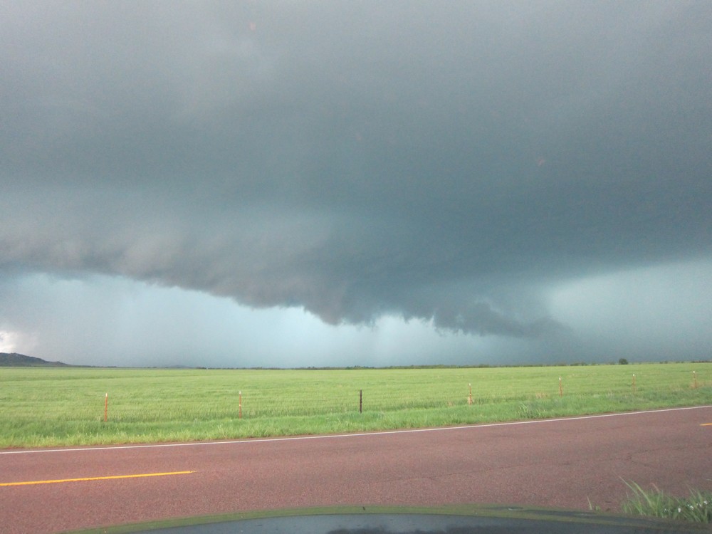
I had to work a fire weather shift on this day, but was able to leave work early. I traveled west on I-40 initially, just in case convection surged north with any intensification in the LLJS. As it turned out, a supercell in southwestern OK made very little east-northeastward progress during my drive. As I drove south on highway 54, this storm came into view, and it was quite apparent that it was an HP.
I sat along the side of 54 for quite a while, unsure if the storm would move due east along highway 62, or move northeast toward my position near Cooperton, OK. I watched the storm go through a rain-wrapped mesocyclone occlusion, after which it then then moved northeast. After the initial meso occlusion, it developed a new wall cloud beneath a milky updraft (it had problems removing precipitation away from the updraft, thus its HP character). Then, a new low-level mesocyclone developed north of the established wall cloud. I drove north to a position about 1 mile southeast of this new meso, and waited patiently to see what it would do. Low-level rotation was obviously strengthening...then a rain curtain wrapped around the meso, and my view of the base was cut off. I decided to slowly move north into the edge of the hook echo. The time was now around 7:30pm. All of a sudden, I saw what appeared to be the entire updraft base at the ground, a giant cylinder emerging out of the rain. I looked northwest, and the edge of a large tornado was directly in front of me, about a quarter mile away. There was no time to take pictures. I quickly put my truck in drive and sped off to the south for about a mile. The rain curtains were rapidly swirling cyclonically around me...I felt relieved when I finally exited the hook echo. Several good YouTube videos of this tornado have been posted...here is a sample:
http://www.youtube.com/watch?v=gR3k1ysd1Ho
http://www.youtube.com/watch?v=vCsZNTdh0nM
This tornado dissipated fairly quickly. I then followed the storm northeast. The sun set, and the LLJS was definitely cranking up. I eventually navigated through the RFD and repositioned myself along the edge of the updraft. Initially, the occluded portion of the updraft to my northwest looked favorable for another tornado. But that area got a cold look, and a new meso formed to my north-northeast. A v-shaped lowering developed, back-lit by lightning, and a brief 20-second tornado occurred. I don't have the exact time of this event, but apparently it touched down close to the town of Carnegie, OK. In addition to this tornado, it was eerily cool listening to the inflow scream through the powerlines positioned along the side of the road.
I then decided one nocturnal tornado was enough for me and ended the chase. However, the battle back home through pouring rain was hell, but I eventually made it back to Norman shortly after 11pm, and celebrated a successful chase by having a couple of beers with a few friends.


No comments:
Post a Comment