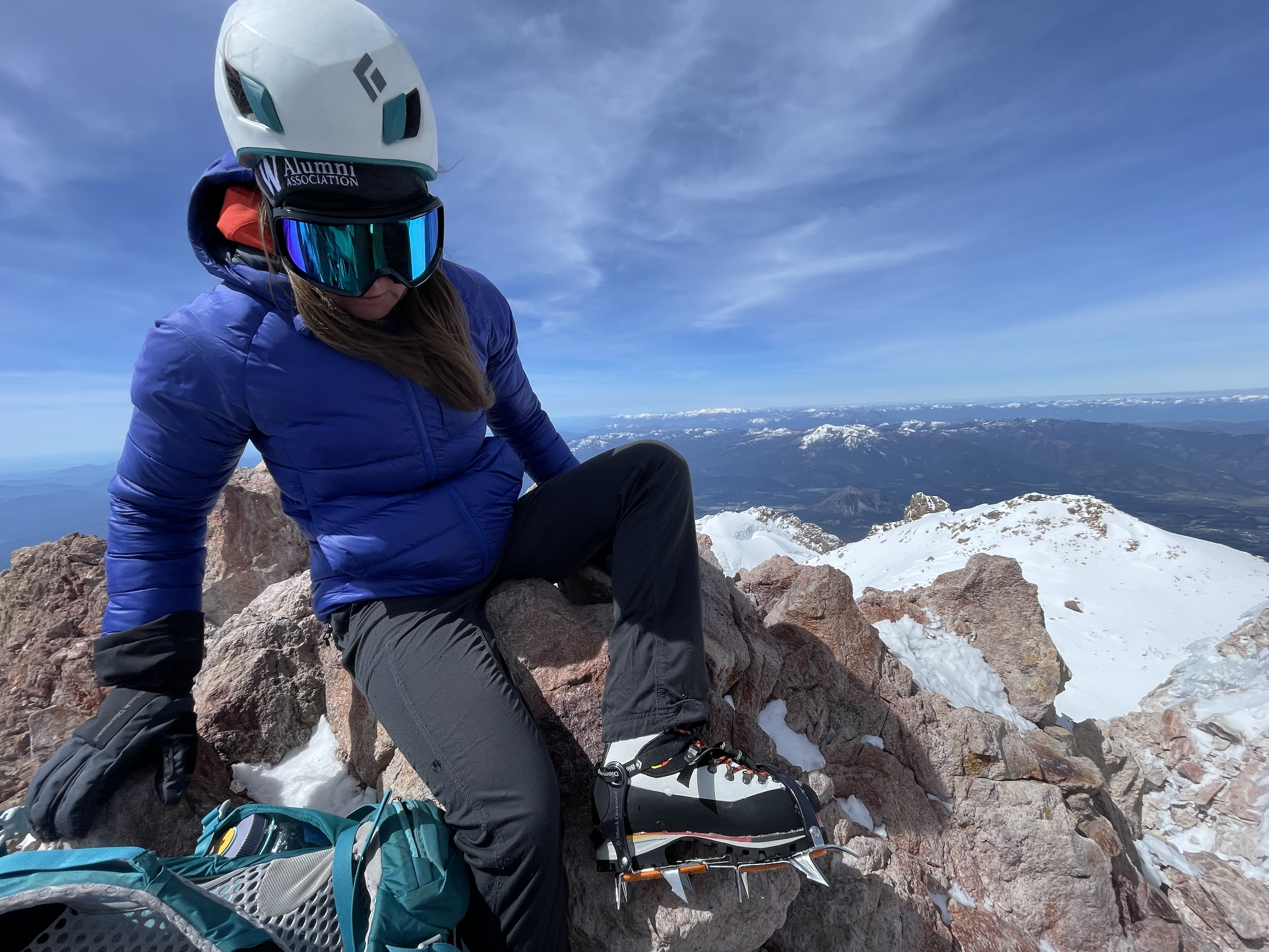
Carly Kovacik and myself departed the Bunny Flat trailhead at around 1 am on May 18th, trekked past Horse Camp, and then ascended up rock and snow to the 50/50 Flat. Another ascent was made past Lake Helen, and then a steeper slope was encountered on the way to the Red Banks. Carly and I put on our crampons at this point...however, a slip on the way to the Banks probably would have resulted in nothing more than a long slide without injury or death. We also had to battle through showers of ice chards raining down upon us from higher up on the mountain. I faced the top of my helmet into the ice storm which protected most of my body from the needle-like daggers of icy debris.
The sun was starting to rise above Shasta by the time we reached the Red Banks, and an ominous cloud cap was swirling above the summit...a clear sign that winds would be hellacious when we got higher on the mountain. We found a chute that gave access through the Red Banks...somewhat steep, but nothing technical that crampons and ice axe couldn't handle. We then traversed left toward and then up Misery Hill. The hill wasn't all that miserable, except for the ever present wind that knocked me over multiple times during the next few hours.
Carly and I continued past Misery Hill, and the wind continued to strengthen...particularly through cols, gaps, and saddles in the mountain terrain. I estimated 70 mph gusts, while Carly's estimate was higher in the 90 mph range. We soon traversed across a large flattish volcanic crater, and the smell of sulfur became substantial despite the wind. The strongest winds were encountered as we departed the crater and approached the base of the final summit block. After a short series of switchbacks we found ourselves at the top.
After a brief respite at the top we started our descent. It was mainly a battle with the wind. The down climb through the Red Bank chute was also interesting...my first steep snow down climb...it took me forever to get down as I front pointed on my crampons with each step and swing of my ice axe, but I made it without incident. We then glissaded down portions of Shasta before running out of steep slope...the snow was also turning soft, so we transitioned to a long slog back to the trailhead. Unfortunately my mountaineering boots were not properly fitted and my feet suffered through some terrible pain. In addition, I didn't apply enough sunscreen to my face, and sunlight reflecting off of the snow resulted in a bad burn that later turned into some hideous swelling.
Map of Mount Shasta can be found here. YouTube video is here.


No comments:
Post a Comment